Cycling
June is Bike Month
Join us for the following cycling opportunities:
- Saturday, June 7 at 9 a.m.: Oshawa Community Ride starting
at the City Hall – North Parkette (King St. W. and Centre St. S), travelling along the Joseph Kolodzie Oshawa Bike Path to Lakeview Park and back. - Wednesday, June 18 at 5:30 p.m.: Scavenger hunt on bikes along the Waterfront Trail at Lakeview Park (starting at Parking Lot G at 1557 Kluane Ave.).

Active Transportation Network
Active transportation is a means of getting around powered by human energy, primarily walking and bicycling.
Just as our existing motorized transportation networks connect destinations via an interconnected system of roadways that enable people to get from A to B, active transportation networks allow people to do the same thing by walking and bicycling. Imagine a system of trails, quiet neighbourhood streets, bike lanes and cycle tracks that connect your home with your work, school, shopping, entertainment and other destinations.
Learn more about our Parks, Trails and Natural Areas
Transportation Master Plan |
|
An Integrated Transportation Master Plan (I.T.M.P.) is a strategic planning document designed to define the policies, programs and infrastructure changes required to meet future transportation needs. It will address planned future growth in the City of Oshawa by developing a transportation system that balances the need for road network expansion with more cycling and pedestrian opportunities while enhancing safety, promoting sustainability and reducing environmental impacts. |
Active Transportation Master Plan |
| An Active Transportation Master Plan (A.T.M.P.) is a strategic plan to improve walking, cycling, and other modes of active transportation. The ATMP will identify a well-connected and safe active transportation network, and promote active lifestyle opportunities and choices for residents, visitors and employees in the City of Oshawa. |
Cycling
Through a system of bike routes, shared roadways, multi-use paths, and trails, the City of Oshawa encourages cycling.
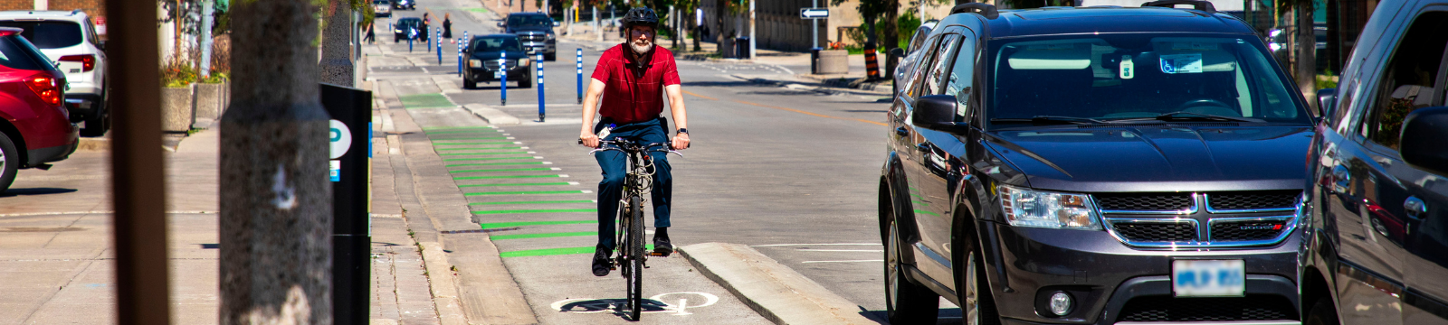
What is a bike route?
A bike route is a designated path or road intended for use by cyclists. Bike Routes are clearly marked with signs and lane markings. Bike route signs indicate where the bike route begins and ends, and communicate to motor vehicles that the roadway is shared with cyclists. Bike routes are also designated by solid or dashed line lane markings and may include bike symbols.
| Type | Description | example |
|---|---|---|
|
Signed only route
Signed only route (with optional sharrows) |
Shared roadway on which cyclists are permitted unless specifically prohibited. "Shared arrow" stencils may be applied sparingly as an optional treatment. Sharrows may be placed in the centre of a narrow travel lane or offset from the curb or parking lane where the travel lane is wide enough for side-by-side travel. They are intended to alert motorists of the expectation to share the lane with cyclists, and to guide cyclists as to where they should ride within the shared lane. |
|
|
Urban paved shoulder |
A portion of a roadway with an urban cross-section (with curbs) which is contiguous with the travelled way and provides cyclists with an area for riding that is adjacent to but separate from the motor vehicular travel portion of the roadway. |
 |
|
Rural paved shoulder |
A portion of a roadway with a rural cross-section (without curbs) which is contiguous with the travelled way and provides cyclists with an area for riding that is adjacent to but separate from the motor vehicular travel portion of the roadway. |
|
|
Bike lane |
This is a portion of a roadway which has been designated by pavement markings and signage for the preferential or exclusive use of cyclists. |
 |
|
Separated bike lane |
Physical separation between cyclists and motor vehicles. Types of separation may include hatched pavement markings, planters, flex bollards, raised medians and on-street parking. |
 |
| One-way raised cycle track | Adjacent to but vertically separated from motor vehicle travel lanes. For exclusive use by cyclists and distinct from the sidewalk. Typically separated by a curb, which may be mountable. |
 |
| Two-way raised cycle track | Adjacent to but vertically separated from motor vehicle travel lanes. For exclusive use by cyclists and distinct from the sidewalk. Typically separated by a barrier curb. |  |
| Two-way
in-boulevard multi-use trail |
Two-way path that is horizontally and vertically separated from the travelled portion of the roadway by a curb and buffer that run in a dedicated corridor separate from the road right-of-way. Multi-use trails are shared by cyclists and pedestrians. |  |

")
Find a cycle route
E-bikes
For the safety of all, it is important that users understand the classification of an e-bike, the rules of the road, and use caution and courtesy when operating e-bikes on our trails.
Learn more about our e-bikes and scooters
Resources
-
Regional Cycling Plan 2021 which identifies key routes for cycling in all eight of the Durham Region's local municipalities.
- Durham Region Transit's Bike and Ride program has installed a bike rack on every bus to encourage cyclists to combine cycling with public transit.
- Ministry of Transportation's cycling skills handbook
- Ministry of Transportation Bicycling Rules and Safety Tips
- Region of Durham Health Department, Bike Safety